|
CHAMONIX TO ZERMATT - Mont Blanc to the Matterhorn, the route is over
180 kms and crosses 11 mountain passes and ascends more than 12000 metres in
height. My inspiration was the Cicerone guide THE WALKERS HAUTE ROUTE by Kev
Reynolds. Once you get your hands on one of these little blue guide books
you are hooked. I noticed that a lot of walkers from various nations use it
as reference book, checking their route for the following day against the
relevant map. I planned to walk just over half the route this year which I
knew would take just about 1 week and then return next year to complete the
rest. The walk from Chamonix to La Sage went as follows... |
|
|
| 21/07/06 - Flight
Liverpool to Geneva, transfer to Chamonix by ATS |
26/07/06- Cabane Du
Montfort to Cabane De Prafleuri 14km - 885m ascent |
| 22/07/06 - Chamonix to Col
De La Forclaz 22km -
1167m ascent |
27/07/06- Cabane De
Prafleuri to Arolla
11k - 735m ascent |
|
23/07/06 - Col De La
Forclaz to Champex 15km
- 876m ascent |
28/07/06- Arolla to La
Sage 10km -215m ascent |
|
24/07/06 - Champex to Le
Chable 13km - 104k ascent |
29/07/06- Bus to Sion,
Train to Geneva |
|
25/07/06 - Le Chable to
Cabane Du Montfort 9km -1636m ascent |
30/07/06- Flight Geneva
to Liverpool |
|
|
|
|
|
After my Tour Du Mont Blanc Walk a
couple of years ago I was determined to return to the Alps to tackle one of
the other trails. I had intended to try the Walkers Haute Route in 2005 but
after reading all the information I could I wondered whether it might be a
little over ambitious for a lone walker and so decided to give it a miss
that year. As a friend of mine said to me "its easy to talk yourself out of
something you are not sure about. Once the opportunity had passed I
instantly regretted it so I made up my mind to go for it the following year.
Seeing as I was determined to go I was quite relaxed about
the trip, I did not book my flight until a couple of weeks before
departure, and the other important things were not booked until a couple
of days before leaving. These were Insurance, Airport transfer and the
first 3 nights accommodation, The one thing that I did do thoroughly was to
study the guidebook and all other reports on the web. By the time I went I
felt that I really did know the route well and knew what to expect along the
way...
|
|
|
Friday 21/07/06 -
The trip began with my Easyjet flight from Liverpool at 14.10hrs, the flight
took off on time and after a comfortable flight I arrived at Geneva at
1700hrs, I collected my rucksack from the carousel and my transport was
waiting for me. I use ATS for the transfer and have always found them to be
excellent. There were about 8 of us on the minibus and I was the first to be
dropped off at my accommodation The Gite Le Vagabond in Chamonix which
I had booked a few days before. I shared a 4 bedded room with 3 others and after unpacking a few items I went out into Chamonix to get something to
eat. I had a wander around and then I settled for a McDonald's, something I rarely do
but when on your own in a strange town it is an easy way to get a bite to
eat. After that it was back to the Vagabond for a couple of beers before
going to bed. It has a great atmosphere and I felt quite at home at this
place.
|
|
|
Saturday 22/07/06 -
I was up early today and after a continental breakfast I set off at 0845
through the town stopping briefly for a photo by the statue in the main
square. I walked along the road out of town to where the footpath
started, it followed the valley floor for a while before gently climbing the
hillside and winding through the forest, it then dropped down into Argentiere and crossed the road to follow the hillside again to Le Tour. I
had a rest break here and as time was getting on I decided to take the cable
car up the hillside towards the Col De La Barme, I had already crossed this
pass on foot in the other direction when walking the Tour Du Mont Blanc so I
did not feel guilty about using the cable car. The charge was 11 euros and
in no time at all I was sat outside the Refuge on the pass. The path
then followed the valley down towards Trient with the last part being quite
steep down through the forest. As I had gained a little time I decided to
walk into Trient for a look round before walking up the hillside to my Hotel
on the Col De La Forclaz. I arrived at 1615hrs after a 7¼ walk including
breaks. 45 mins later there was a storm with thunder, lightning and very
heavy rain. which lasted for several hours. The early arrival after using
the cable car certainly prevented me from getting wet. The evening meal was
excellent, soup followed by chicken with chips and cauliflower, there were
second and third helpings if you wanted. Ice cream for desert. Its a quiet
place once the passing traffic has ceased and there is really nowhere to go
for a stroll except downhill but I stayed here on the TMB and find it good
value with excellent views down the valley on both sides |
|
|
Sunday 23/07/06 -
After breakfast of bread, cheese, toast and jam it was time to set off.
There was a choice of 2 routes, one was then high route over the Fenetre D'
Arpette which is a spectacular route and one I would like to do again.
However I chose to walk the Alps Bovine Route which is slightly longer but
easier and would be a good choice in the event of bad weather. The weather
today was excellent and the route climbed easily along the hillside and then
up through the forest, I passed a farm building called La Giete which was in
an open grass basin, and was amazed to hear someone playing what I took to be
an Alpine horn, the sound echoed around the mountains, a unique experience,
I recorded some of the sound with my digital camera, they are not just for
taking pictures. After more larch and pinewoods I emerged onto the open
mountainside with good views down into Martigny, in the distance I could see
the Alp Bovine which I reached 2 hours after leaving the hotel. I stopped
here for lunch which was a cheese sandwich and a coffee. Then it was off
along the hillside before dropping steeply down through the woods to
reach the valley. The path then wandered along past farms and chalets before
changing to a track then a lane and then into Champex about 5 hours after
setting off this morning. I had booked a bed at Pension En Plein Air a few
days ago on the internet, they do not open till around 1600hrs but once open
I was shown to a nice twin bedded room which I had to myself. I had a shower
then wandered down the road to the lake and had a large beer in a cafe
on the lake shore. |
|
|
|
Monday 24/07/06 After a phone call to
reserve a bed at the Hotel du Gietroz in Le Chable I set off from Champex in
bright sunny weather, the route followed country lanes and tracks
along the hillside through the village of Sous La Le and then onto the
village of La Garde. The path then followed the hillside to the Chapel of
St Jean which stands in a prominent position overlooking the valley, after
leaving the Chapel the path descended through woodland to the attractive
village of Sembrancher where I had lunch sitting in the village square with
other walkers I had met during the day. The way ahead to Le Chable lay along
the valley floor before climbing up through woods and then it
descended again and then along tracks and lanes into Le Chable. I found the
Hotel du Gietroz, checked in and had a shower, I was informed that the
restaurant was closed on Mondays so I wandered next door to the Pension Les
Ruinettes for a beer and met up with the other walkers who had got rooms
there. They served food in the evening so I returned there in the evening
and enjoyed an excellent meal in their company. I had a Cheese, ham and
mushroom omelette with salad and chips 19CF, large beer was 5.50CF. Bed and
breakfast at the Hotel Du Gietroz in an en suite room was 80CF. I
phoned the Cabane Du Mont Fort for Tuesday night and Cabane De
Prafleuri for Wednesday night as I wanted to make sure of a bed because
there is no real alternative in the high mountains ahead' |
|
|
|
Tuesday 25/07/06 After a breakfast of
bread, butter and jam with tea and orange juice I set off at 0745hrs through
Villette and climbed up the hillside with great views over the valley, today
there was to be a height gain of 1636m which was to be the maximum daily
height gain for the whole walk. Despite the climb the walk was fairly
easy along paths and tracks up through the forest to the junction of paths
at Clambin, a rest break at the restaurant afforded marvellous views out
over the valley. The path upwards became easier and started to level out
along the hillside and there were great views of the Grand Combin in the
distance. The area was criss crossed with cable cars and ski lifts for
use in the winter. The weather was sunny and there were many walkers
following the paths along the ridge. At around 1400hrs I arrived at the
Cabane Du Mont Fort. Set on a bluff overlooking the valley the refuge was
clean, modern and provided excellent accommodation. I had a small two bedded
room to myself and the evening meal consisted of Veg soup, mixed salad,
spaghetti bolognese followed by chocolate mousse. Breakfast next morning
was tea with bread and jam and the cost for half board was 70CF, a picnic
lunch was 10CF. |
|
|
|
Wednesday 26/07/06
After breakfast I left the refuge at 0745hrs and followed the path which is
called Sentier des Chamois, this is a superb path with fine views, narrow in
places with but always within the capabilities of the average mountain
walker. After 1¾hours I arrived at the Col Termin
with some of the other walkers who were heading to the same refuge as I was.
After a rest stop the path changed direction and headed north east towards
the Col de Louvie, there was a great sense of heading into a wild and
desolate area, the scenery was magnificent, there were several groups of
walkers heading along the trail towards the pass and it was tremendously
exciting to climb up to the summit of the pass and look out over the Grand
Desert Glacier. This was a good place to stop and enjoy the view, overhead
on the cliff above we saw several ibex with a young one looking down at us surveying the scene.
After a rest break the path descended to the valley floor beneath
the Grand Desert Glacier, this was a remote place and although there was no
danger, it was a case of picking your way through boulders, streams and
small ponds. Across on the other side of the there was a large marker which
the guidebook indicated was the place to head for. It was enormous and was
obviously intended to guide you across in poor weather conditions although
in poor visibility it would not be possible to be seen from across the
valley. Nevertheless there were hundreds of smaller painted markers guiding
the way across. Then it was a steady climb up to the Col De Prafleuri at
2965 metres, the highest point so far. Below is an enormous quarry floor
which I believe was quarried around 50 years ago to provide material for the
Dam in the next valley. It was a desolate place of gravel beds and paths
with peaks all around. After crossing the quarry floor the path drops to
left and you finally see the Cabane De Prafleuri on a rise overlooking the
valley. It had started to rain as I reached the hut and the weather was
closing in. For the next few hours there was thunder, lightning and
hailstones and the mountainsides were streaked with powerful streams
tumbling down from above. Accommodation was spotless and the dormitory I
slept in had a large communal bed sleeping eight on each side of the
room. Showers were 3CF and half board was 56CF, the evening meal was
excellent and consisted of soup to start with, followed by a mixed salad,
after this we had pork in mushroom sauce with pasta strips and rice, there
were second helpings for anyone who wanted more. As a desert we had Apricots
and ice cream. Breakfast next morning was cereal, bread and jam, cheese
squares and a nice mug of tea. I ordered a picnic lunch and this consisted of
2 slices of bread, a piece of cheese, a piece of salami, a bag of crisps, a
Mars bar, a bag of mixed nuts and a small bottle of water- 12 CF. There was
no public phone and you could not get a signal on your mobile. The water in
the refuge was not drinkable according to the signs. It looked as if it was
straight of the glacier, full of silt. Obviously it was bottled water we
were given to drink. |
|
|
|
Thursday 27/07/06
The weather today was sunny with clear blue skies and excellent
visibility and after a short climb of 160 metres from the refuge up to
the Col Des Roux there was a superb view of the Lac Des Dix, the path
descended easily down to the shore and there followed an excellent track
along the shoreline to the far end of the lake, the views of the
surrounding mountains were superb. At the end of the lake the path
climbed steadily upwards and along the valley, alongside the torrent
which drains the Glacier de Cheilon which lies ahead. There are two
routes into the next valley the first is up to the Col De Riedmatten and
the path zig zags up the left hand side of the valley and then climbs
steeply up to the narrow notch which is the Col De Riedmatten. There
is a superb view from here and the Matterhorn is clearly visible from
here nestling behind the mountains to the east. The alternative route is
over the Pass des Chevres which is a short distance further on but this
entails a climb up three near vertical ladders. Some of my companions
went that way and described it as OK but with a packed rucksack I think I
made the right choice. The path then descended steeply down into a
pleasant valley with excellent views all round. It was then an easy walk
along paths and tracks down the valley and into Arolla. Once down
in the village I went straight to the Hotel Du Glacier and was able to
get an excellent room overlooking the village square. I planned to stay
two nights and then leave for Geneva on the Saturday morning. The Friday
was really a spare day which I could have used anywhere on the walk but
as I did not feel overtired I decided to walk the next day to La Sage
and catch the bus back to the Hotel. half board at the hotel was 73 CF
and was good value, the room was great (not ensuite) and the food was
excellent. I slept well that night after my nights up in the
mountains particularly after several large beers at 5.50 CF each. I felt
really pleased with myself having got this far and achieved what I had
set out to do. |
|
|
Friday 28/09/06
The weather again was good and after breakfast at the Hotel I set off
for the 10 km walk to La Sage. The path follows the wooded hillside for
several kms before coming out onto the open hillside at Lac Bleu,
it was well named and quite a nice spot for a rest break, the path then
descended past a small alp hamlet where refreshments were available and
continued down to the village of La Gouille. the route then crossed the
road and wound down the valley through meadows and forests eventually
reaching Les Haudres. This was a large village and was somewhere I will
have to return to for a good look round. After walking through the
village the path climbed steadily up through the trees for several kms
to the small village of La Sage, this was the end of my walk for this
year and will be my starting point for the next section which I will
hopefully return to complete next year. As it was still early I decided
to walk back to Les Haudres to catch the bus back to Arolla. There is a
bus service but the village was very quiet and the walk back was all
downhill. About halfway back the rain started and it was on with the
waterproofs for the rest of the walk back to Les Haudres. The rain was heavy enough to
make me seek shelter on the outskirts of the village until it
eased off. The bus arrived promptly and I had an enjoyable ride back to Arolla. Back at the hotel I spent an hour repacking all my walking gear
back into my rucksack ready to start the journey home the next day.
|
|
|
Saturday 29/07/06 The Easyjet flight
leaves Geneva at 1245hrs each day and I did not think it would allow me
enough time to catch the plane after travelling from Arolla so I planned
to stay the night in Geneva and catch the plane home on Sunday.
After breakfast I caught the 0825hrs bus from the village square to Sion
(fare 19.80CF) where I arrived at 0945hrs. The bus terminus was outside
the train station so it was just a short walk into the station where I
bought a train ticket (fare 47CF) for Geneva Airport, the train left at
1005hrs, there was plenty of room on the train and I had a very
enjoyable journey watching the Swiss countryside speeding by. The train
arrived at Geneva Airport at 1215hrs and although I had seen a Hotel on
the Internet which was quite close to the Airport I wondered if I could
find another hotel nearby. I enquired at the Tourist
Information Counter in the Arrival hall and they recommended a Hotel
close by called the Nash Airport Hotel, the
price was 100CF for bed and breakfast plus 5CF booking fee. Within 15 mins a minibus arrived to collect me and other guests, many of whom were
pilots and cabin staff who apparently stay there when off duty. The
hotel was excellent with clean and modern rooms with a good public bus
service (fare 3CF) into the centre of Geneva which was about 3 kms away.
I spent a pleasant afternoon exploring Geneva and then it was back to
the Hotel for the evening. |
|
|
Sunday 30/07/06. As the airport was
close I decided to walk to the Airport where I had to wait an hour for
the check in to open, the flight left at 1245hrs Swiss time and arrived
back at Liverpool at 1345hrs. An excellent flight and after
being picked up from the airport by my son it was back to reality.
Looking back on the holiday I will treasure all those moments. The
mountains I crossed. the people I met, the places I stayed, all
wonderful memories. I am glad that I made the decision to go, and
look forward to returning next year to complete the walk to Zermatt,
starting this time in La Sage |
|
Equipment |
|
|
Lowe Alpine Rucksack 35 litres
Brasher Walking Boots
Sprayway Fleece
Zip off walking trousers
Spare pair of shorts
Lightweight trousers for evening wear
Lightweight shoes for evening
3 T shirts
Short sleeved shirt best shirt
1 Long sleeved shirt
Rab Micro fleece Sweatshirt
Food was purchased daily
2 litre Platypus water container only full
when on the long stretches, plus a 75cl water bottle
2 Digital cameras Fujifilm 602 Zoom and
small compact Nikon 5600
The weight was just over 20lbs without
food and water and
everything carried was necessary although I did not use the
sweatshirt and gloves I would still recommend carrying them. I had generally
good weather throughout but there were occasional storms in the late afternoon
|
3 pairs of walking socks
3 pairs of lightweight socks for evening
4 pairs underpants
Sleeping bag liner (silk - very light) and
pillow case
Lightweight waterproof trousers and jacket
Travel towel and toiletries
Compass, whistle, maps and guidebook
Head torch, compass and sunglasses
Sun cream
Mobile phone and charger
Binoculars
2 Cameras - Fuji film 602 Pr0 Zoom and small
Nikon Coolpix 5600
Spare AA batteries for cameras
Hat and gloves
Leki Malaku Walking Pole
Map - Mont Blanc Grand Combin
1:50 000 - Number 5003 by Swisstopo - this covers the route from
Chamonix to Arolla. The scale was OK but I would prefer a larger
scale for the higher parts of the walk, particularly the crossing of
the Grand Desert. |
|
|
|
| |
Costs and links |
|
Costs |
|
BMC Treking Insurance
Covers you for Treking in the Alps
Don't go without it |
£27.00 |
£27.00 |
|
Easyjet Flight Liverpool to
Geneva plus Easyjet Insurance
Great flight |
£223.43 |
£223.43 |
|
Transfer from Geneva to Chamonix
by ATS - one way -
Door to door - Hassle free |
£30.42 |
£30.42 |
|
Accommodation in Chamonix at Gite
Le Vagabond - Bed and breakfast
Good value |
20.90 euros |
£14.01 |
|
Accommodation at Hotel de la
Forclaz - Half board room with en suite
Good location on pass |
100 cf |
£46.08 |
|
Pension en Plein Air in Champex -
Half board
Good value |
77.50 cf |
£35.71 |
|
Hotel du Gietroz in Le Chable -
Bed and Breakfast - ensuite
Quiet |
80 cf |
£36.86 |
|
Cabane Du Mont Fort -
Mountain Refuge - Half board
Great views |
80 cf |
£36.86 |
|
Cabane de Prafleuri - Mountain
Refuge - Half board
Great views |
59 cf |
£27.18 |
|
Hotel Du Glacier - Arrolla
- 2
nights half board - not ensuite 77.25CF per night
Great location |
154.50 cf |
£71.19 |
|
Journey - Arolla to Sion - bus
19.80 CF - Sion to Geneva train 47 CF
Great journey |
66.80 cf |
£30.78 |
|
Nash Airport Hotel - Geneva - 100
CF bed and breakfast plus 3.47 booking fee
Modern and next to Airport |
103.47 |
£47.68 |
| |
Approximate costs for nine
nights of a superb walking holiday |
|
£627.20 |
| |
Costs are based on an exchange rate
at the time of 2.17 Swiss francs to the pound - Euros 1.41 to the pound.
I could have done the trip for less cost if I had booked my flight
earlier in the year and saved 50% of the flight cost. There were
occasions where I could have stayed in cheaper accommodation and saved
money but looking back I think I made the right choices. I have
not included refreshments such as beer, coffee and snacks.
|
| |
|
|
|
|
|
|
|
Photos of the Walk |
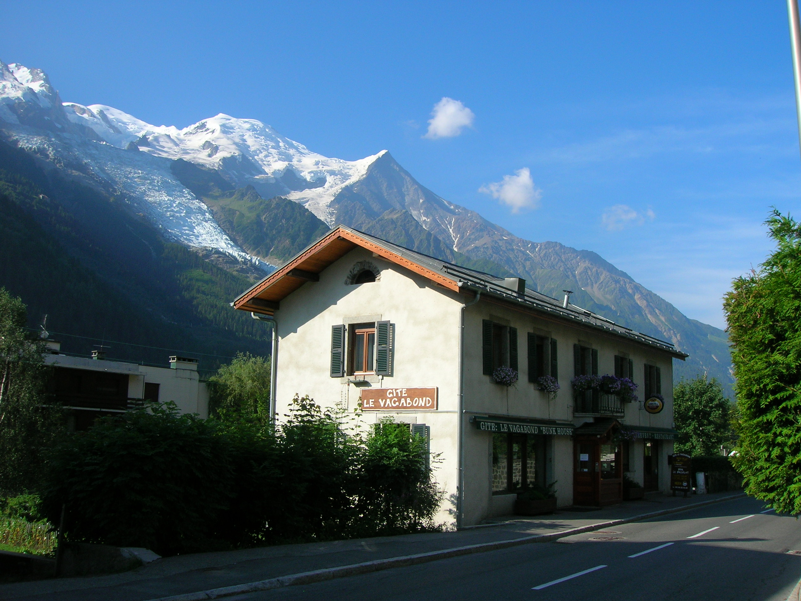
Saturday 22/07/06 |
| Gite Le Vagabond
in Chamonix - A friendly relaxed 150 year old oak beamed and stone built
hostelry Bed and breakfast in a four
bed room was 19.40 plus a laundry charge of 4 euros for laundering for up to
a 7 night stay... |
|
 |
| |
|
| This is it - the
starting point for weeks walk the statue in the
square at Chamonix |
|
 |
| |
|
| The path winds
through the woods on the way to Argentiere |
|
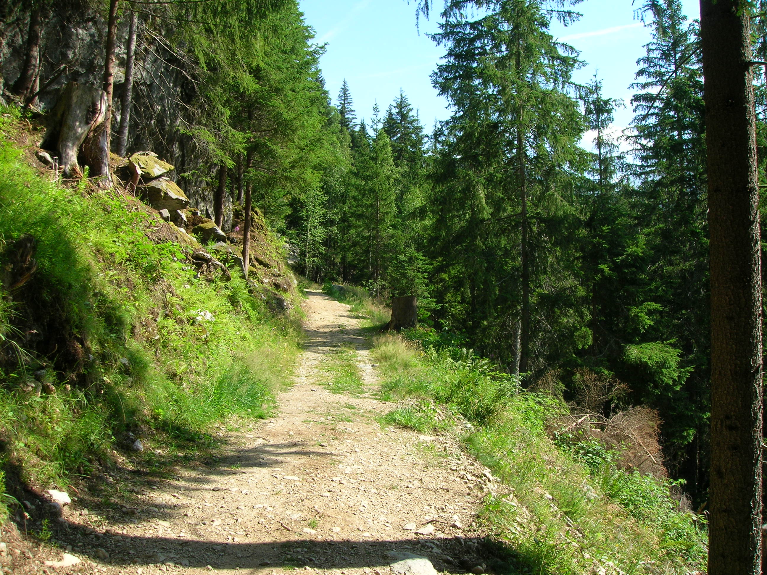 |
| |
|
|
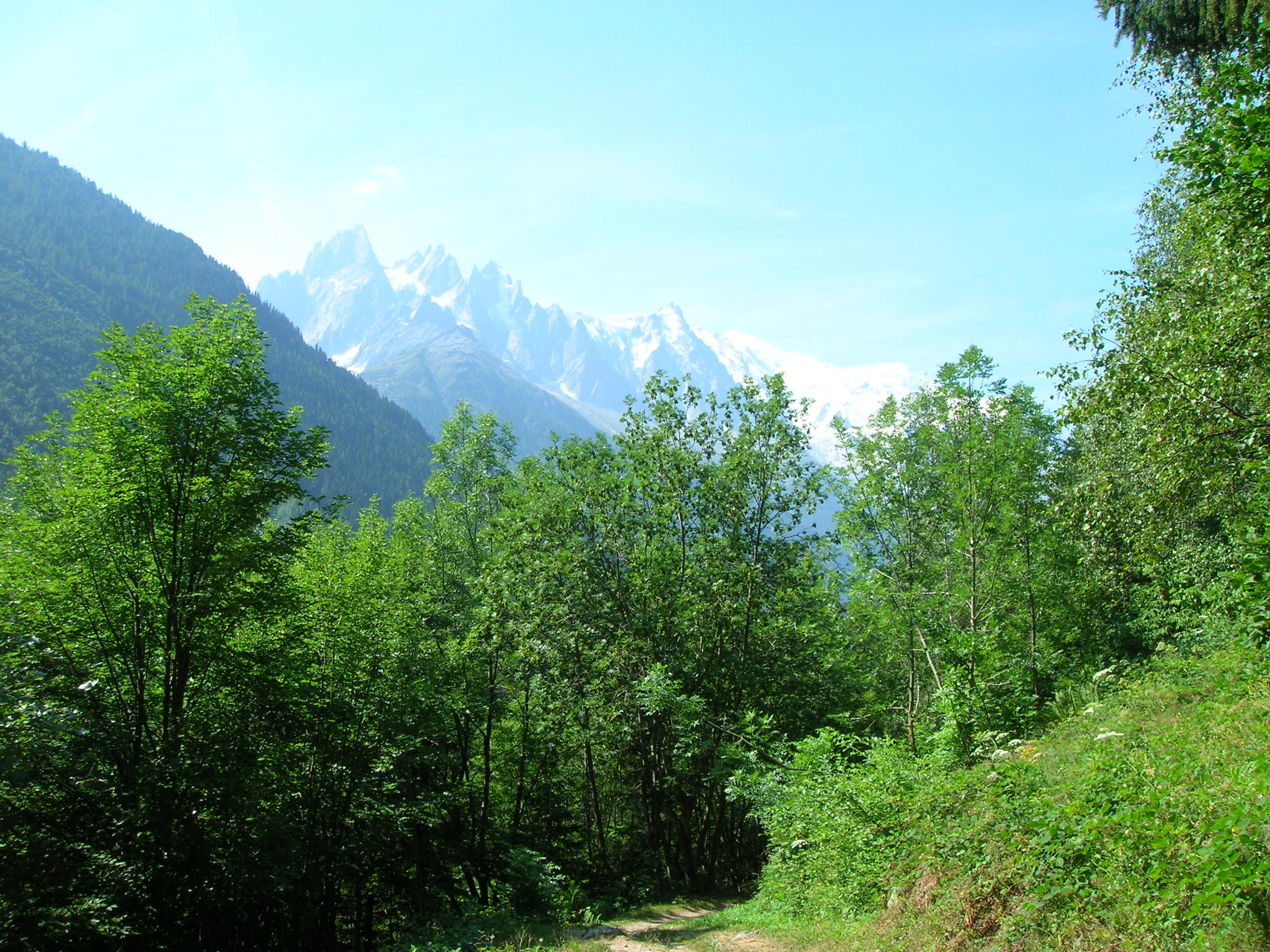
Looking back at
the Mont Blanc range |
|
 |
| |
|
| This is the border
between France and Switzerland |
 |
| |
|
| The refuge on the
Col de Balme on the border between France and Switzerland |
 |
| |
|
| After leaving the
Col du Balme and as you get down the valley towards Trient there is a great
view of the Glacier du Trient on your right |
 |
| |
|
| Looking down
towards Trient - The Hotel du Col de La Forclaz is halfway up the hillside |
 |
| |
|
| The Hotel du Col
De La Forclaz - 100cf for a single room en suite with demi pension
(half board) - excellent meal in the evening |
 |
| |
|
|
Summary
Distance 22km - height gain 1167metres - Started at 0900hrs and had a
good days walking along paths which wound their way along the Chamonix
Valley through Argentiere and Le Tour. As I had previously crossed the Col
De Balme on foot I took the cable car up from Le Tour (11 euros) this saved
me a little time and I was able to have a look around Trient before walking
up to the hotel on the pass. I arrived at 1615hrs just before a massive
thunderstorm arrived, the air was full of thunder, lightning, hailstones and
torrential rain. very exciting when viewed from your hotel room.
|
|
|
|
Sunday 23/07/06 |
|
| A barn on the Alp
Bovine route, there was someone playing the Alpine horn here and it echoed
around the mountainside. Absolutely fascinating |
 |
| |
|
| Alp Bovine - a
good place for refreshments and what a view while you relax |
 |
| |
|
| The views after
you leave Alp Bovine are even better |
 |
| |
|
|
Pension En Plein Air good
dortoir and rooms 72 cf for half board and I had a twin bedded room to
myself |
|
 |
| |
|
|
Summary
Distance 15k - height gain 876km - 5½hrs of walking. I chose to use the Alp
Bovine Route as I had already crossed the Fenetre d' Arpette in 2004 when I
completed the Tour Du Mont Blanc. Although not as spectacular as the high
pass the Alpine Bovine Route was enjoyable with good views, it started in
the forest near Col de la Forclaz and then crossed open hillside near Alp
Bovine, I stopped here for lunch and then the path carried on around the
hillside with great views before descending steeply through the forest and
then following valley footpaths and minor roads into Champex
|
|
|
|
Monday
24/07/06 |
|
| The track
between Champex and Sembrancher |
 |
| |
|
| Looking down
from the track at the haymaking in the fields below |
 |
| |
|
| Further on
along the track heading towards Sembrancher |
 |
| |
|
| This is the
beautiful little chapel of St Jean on the hill overlooking Sembrancher |
 |
| |
|
| Sembrancher
below and Le Chable is behind the hillside on the right. The track is on the right of the
picture before it disappears into the forest |
 |
| |
|
| I stayed
here at the Hotel Du Gietroz - 80cf for bed and breakfast with en suite room.
It was very clean and quiet |
 |
| |
|
|
I had my
evening meal here with other walkers I had met on the trail. It was
next door and they stayed here and said it was fine, and they also reckon
they had a full English breakfast, I was envious! |
|
 |
| |
|
|
Summary
Distance 13km - height gain 104metres - about 4 hours walking through rural
Switzerland, you pass through several small villages which are very
pleasant. Lunch of bread and cheese from a small shop in Sembrancher. An
enjoyable walk during which I met some other walkers doing the same route.
They were Ben and Anthony from the south of England, Kammila and Eungne from
Denmark and Shuam from Hong Kong. Hope I've got all the names correct, I
enjoyed there company and friendship during the coming days. |
|
|
|
Tuesday 25/07/06 |
|
| Leaving Le Chable
the route winds it way up through the village streets |
|
 |
| |
|
|
Looking back down
on Le Chable |
|
 |
| |
|
| Although most of
the walk today is up hill when you stop to rest you get a great view
back down into the valley |
|
 |
| |
|
|
Another pause to
get my breath back |
|
 |
| |
|
| The view down the
valley, Le Chable below and Sembrancher out of sight down the valley |
|
 |
| |
|
| A level bit on the
mountainside, the bisse path I had just come along can be seen curving
around the mountain |
|
 |
| |
|
| The Cabane Du Mont
Fort - My accommodation for the night - very comfortable I had a 2
bedded room to myself - Half board was 70 CF. The evening meal was
excellent and consisted of vegetable soup, mixed salad, spaghetti
Bolognese, followed by chocolate mousse.
There was another storm about 5.00pm
with thunder and lightning |
|
 |
| |
|
| |
|
| View from the
terrace of the Cabane Du Mont Fort, the path from the refuge goes up to
the Col De la Chaux which is the alternative route to the tomorrow
nights refuge - The Cabane De Prafleuri |
|
 |
| |
|
| The view North west
from the terrace of the Cabane Du Mont Fort |
|
 |
| |
|
| A nice clean bed in
the small 2 bedded room |
|
 |
| |
|
|
Summary - An uphill day today - 1636
metres of ascent in 9 km, the weather was ideal and although it was mostly
uphill it was an enjoyable day, it was just a case of keep plodding along
and enjoying the magnificent views. A good rest stop about half way up is
Clambin where there are good refreshments available |
| |
|
|
|
Wednesday
26/07/06 |
|
| Myself and the
friends I met along the way just before we set off for the Cabane
Prafleur Front row Shum
from Hong Kong and Ben from the South Coast
Back row Eungne and Kammila from
Denmark, Anthony from the South Coast and myself |
|
 |
| |
|
| Looking back up at
the Cabane Du Mont Fort where I had just spent the night |
|
 |
| |
|
| Looking back along
the path towards the Cabane Du Mont Fort which is perched on the raised
ground in the centre of the picture |
|
 |
| |
|
| This appeared to be
the result of last nights storm and was clearly where the water and
debris had been swept down the mountainside, it was a like a plowed
furrow that went straight down to the valley below
It was an incredible sight
and there were many more like this on this section of the walk |
|
 |
| |
|
| Kammila and Eungne
crossing one of the results of last nights storms
I would not like to have been
anywhere near this area last night
Quote from Kev Reynolds book
Chamonix to Zermatt - The Walkers Haute Route
"On this walk you are witness
to the ceaseless toil of erosion. The mountains are dying, falling apart
and to wander through their scenes of destruction is a sobering
experience"
|
|
 |
| |
|
| Looking back along
the path after we had rounded the corner |
|
 |
| |
|
| Looking along the
path I was a bit apprehensive about where the path climbed up over the
shoulder but it was a lot easier than it looked once I got up to it -
Part of the Grand Combin is in the distance |
|
 |
| |
|
|
Rest stop on the
Col Termin |
|
 |
| |
|
| Col Termin 2648m
with Grand Combin in the distance |
|
 |
| |
|
| The path from the
Col Termin towards Col Du Louivue which is the low point on the ridge,
about 1½ hrs away |
|
 |
| |
|
|
|
 |
| |
|
| Another view of the
Col Du Louvie |
|
 |
| |
|
| Looking back from
the Col Du Louvie 2921m to the Col Termin which is the notch at the
bottom of the ridge that slopes down from the peak |
|
 |
| |
|
| While having a
break on the Col Du Louvie I glanced up at the peak above and spotted
this Ibex, this is taken with the zoom lens |
|
 |
| |
|
| On the Col Du
Louvie with the Grand Desert behind me. This is a barren wilderness of
screes, moraine and the glacier coming down from Rosablanche on the
right of the picture just out of sight.
Its an exciting place to be and was
one of the highlights of my trip |
|
 |
| |
|
|
I followed this
walker down the snow slope and about halfway down I slipped and slid on
my bottom all the way down the the slope much to the amusement of other
walkers. Only my pride was hurt, but it just goes to show mishaps can
happen anytime. I must have slid 20-30 metres and just came to rest at
the bottom when the snow changed to scree |
|
 |
| |
|
|
A glacial lake in
the middle of the Grand Desert, the recommended route goes to the left
of the lake but as the glacier had receded well back from the lake we
crossed to the right, it was fine but there were several fast flowing
and ice cold streams to negotiate.
The whole route is marked with
frequent markers and on the far side there is an enormous waymark
painted on a boulder. In the picture you can just see a small white
speck just over halfway up the slope. This is the very important marker
stone and in the case of bad weather is probably one of the most
important waymarks you will ever see |
|
 |
| |
|
|
The big marker on
the other side of the Grand Desert. Note the wild flowers |
|
 |
| |
|
| A wild and
beautiful area, this was one of the easy streams to cross |
|
 |
| |
|
| One of the fast
flowing streams that were flowing down from Rosablanche |
|
 |
| |
|
| There are wild
flowers everywhere in this inhospitable area |
|
 |
| |
|
|
Plenty of markers
along the route, very important as I would imagine in bad weather it
would be very easy to miss some of them |
|
 |
| |
|
| Note the flowers
everywhere in the sheltered places |
|
 |
| |
|
| Another view looking back over
the Grand Desert to the Col Du Louvie |
|
 |
| |
|
| A welcome
sight, the highest I've climbed 2965m |
 |
| |
|
|
Looking down from
the Col De Prafleuri, there are two walkers crossing the quarry floor in
the centre of the picture. apparently this quarry was solely for the
purpose of providing material for the dam in the next valley, a true
feat of engineering, More about that later |
|
 |
| |
|
|
Cabane De Prafleuri
Half board was 56
cf - showers 3 cf - water was not drinkable and there was no phone
available or mobile phone signal
Evening meal was
excellent and consisted of Soup, mixed salad, pork in mushroom sauce
with pasta strips and rice followed by Apricot and ice cream |
|
 |
| |
|
|
There was another
storm again tonight and looking out from the refuge showed swollen
streams cascading down the mountainside. You can see the remains of the
quarry workings quite clearly from here
There did not appear to be any
access road to this refuge and I asked the guardian how they got
supplies. She answered "through the tunnel" apparently a 2 km tunnel was
constructed from this quarry to The Grand Dixance Dam.
The Dam which is the highest in
Europe is 285 metres high and 700 metres long and holds back Lac Le Dix
which contains 400 million cubic metres of water. Some photos of the
lake are on the next days walk |
|
 |
| |
|
|
One of the large
beds in the room I stayed in, there were 9 on this side and 8 on the
other. All very clean and modern but some light sleepers may need ear
plugs |
|
 |
| |
|
| |
|
Summary This day was the highlight of the
trip so far, it took around 6½ hours but seemed longer, the views all
along the route were spectacular and the crossing of the Grand Desert
was something I will always remember. There were no roads or buildings
anywhere in sight, just a line of markers, soaring peaks, fast flowing
streams and wild flowers. A wonderful sense of the wilderness. This is
one walk that I want to do again |
|
| |
|
|
|
Thursday
27/07/06 |
|
| A bright morning at
the Cabane De Prafleuri |
|
 |
| |
|
|
On the Col Des Roux
2804m which is 20 minutes from the Refuge. Lac Des Dix is below. The
paths winds down the mountainside and then follows the lake shore to the
top end of the lake. It then climbs upwards heading for the Col De
Riedmatten |
|
 |
| |
|
|
Heading down from
the Col Des Roux |
|
 |
| |
|
|
This was a tricky
bit, the metal spar was part of the footbridge and it looked as if the
rest had been swept away. To get across you had to place your
hands as far out as possible on the spar and then jump. Not as
difficult as it seems once you have done it |
|
 |
| |
|
| Refuge De la
Gentiane La Barma on the shore of the lake |
|
 |
| |
|
|
There is an inflow
of water at the far end of the lake which pours out of a tunnel, quite
impressive when you get up to it |
|
 |
| |
|
| The water level was
quite low in the lake |
|
 |
| |
|
|
Looking west at
the end of the lake |
|
 |
| |
|
|
The suspension
bridge at the end of the lake |
|
 |
| |
|
| Another tricky bit
crossing one of the ravines on the way to the Col De Reidmatten |
|
 |
| |
|
|
Looking across the
valley to the Cabane Des Dix which was one of the alternative routes on
this walk |
|
 |
| |
|
| Looking south as we
climbed higher - Mont Blanc de Cheilon |
|
 |
| |
|
|
|
 |
| |
|
|
Another fine view
of Mont Blanc de Cheilon |
|
 |
| |
|
|
The low notch on
the left is the Pas de Chevres, there are about 22 metres of steel
ladders bolted to the rock face.
I took the route over the Col
De Riedmatten which is on the left before the Pas de Chevres |
|
 |
| |
|
|
On the Col De
Riedmatten, that is the Matterhorn on the skyline. Easily identifiable
before the cloud drifted across This was the only time I caught a
glimpse of the final destination. As soon as you drop down of the Col
you lose sight of it.
Next year with a bit of luck I
hope to finish the walk in Zermatt |
|
 |
| |
|
| Another view of the
Matterhorn peeping out from the clouds |
|
 |
| |
|
|
Heading down the
valley towards Arolla |
|
 |
| |
|
| Looking back up the
valley towards the Col De Riedmatten |
|
 |
| |
|
| I stayed here for
the Thursday and Friday nights at the Hotel Du Glacier. Very nice - 73CF
for half board - not en suite but very comfortable |
|
 |
| |
|
|
Summary Another very
enjoyable day with good weather, after crossing the Col Des Roux there was
the pleasant walk alongside Lac Des Dix and then the climb up over the Col
De Riedmatten and down to Arolla - about 6½ walking |
|
|
Friday 28/07/06
Arolla to La Sage |
|
| After leaving
Arolla the path follows the hillside through some very attractive woods |
|
 |
| |
|
|
Looking back
towards Arolla |
|
 |
| |
|
| The path passes Lac
Bleu - you can see where it gets its name |
|
 |
| |
|
| Further along the
trail towards Les Hauderes |
|
 |
| |
|
| Just below Lac Bleu
there is a tiny alp hamlet called Louche where refreshments were
available |
|
 |
| |
|
|
Another view of
Louche from below |
|
 |
| |
|
| The track on the
hillside heading towards Les Hauderes |
|
 |
| |
|
| A small Chapel at
the roadside, note the climber on the rocks behind |
|
 |
| |
|
|
Looking down on
Les Hauderes |
|
 |
| |
|
|
The minor road
heading down towards Les Hauderes |
|
 |
| |
|
|
The village of Les
Hauderes |
|
 |
| |
|
|
Another view in
the the village of Les Hauderes |
|
 |
| |
|
| A typical farm
building built on the raised pillars to deter rodents |
|
 |
| |
|
|
The minor road
leads up towards La Sage |
|
 |
| |
|
| The road in the
centre of La Sage - The path for the next stage of the journey to Cabane
De Moiry starts here |
|
 |
| |
|
| Journeys end for
now. The valley I had just come down from Arolla is on the right of the
picture. The walk to
Zermatt from La Sage starts here |
|
 |
| |
|
|
Summary - The walk from Arolla to La Sage took around 4 hours and was a
pleasant end to the first part of my walk. I had completed around 99 kms
in seven days. The walk passed through a great variety of scenery and I
am looking forward to completing the rest of the walk next year |
|
| |
|
|
|
| Return
to main page |
|
| |
|
